












African Physical Map Wall Chart
Price Comparison
takealot.com
Best Deal
In stockThe Story
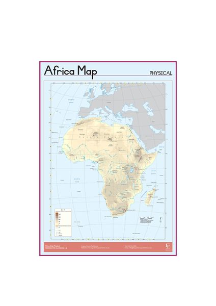
This educational wall chart features a detailed physical map of Africa, highlighting countries, mountains, rivers, waterfalls, and other geographical features. Printed in full color on uncoated paper, it is an excellent learning tool for classrooms, homeschools, or any study space. The chart provides a clear and engaging visual reference for students and geography enthusiasts.
add_circle The Upside
- check Comprehensive physical features for learning geography
- check Bright colors enhance visual appeal
- check Large size suitable for wall display
remove_circle The Downside
- close Uncoated paper may be less durable
- close Only front side has printing
- close No additional interactive elements
Specifications & features
Key features
- check_circle Full-color physical map of Africa
- check_circle Shows countries, mountains, rivers, and waterfalls
- check_circle Printed on uncoated paper
- check_circle Large wall chart format
- check_circle Educational and easy to read
Specifications
Paper Type
Uncoated Paper
Printing
Full Color (Front Only)
Product Type
Wall Chart
Subject
African Physical Map
Tags
Recommended
Explore related categories
More in Teacher Supplies






Keep discovering
Sign in to browse more of your personalised feed (new accounts use social login).