











Lingua Franca Publishers
Wall Charts
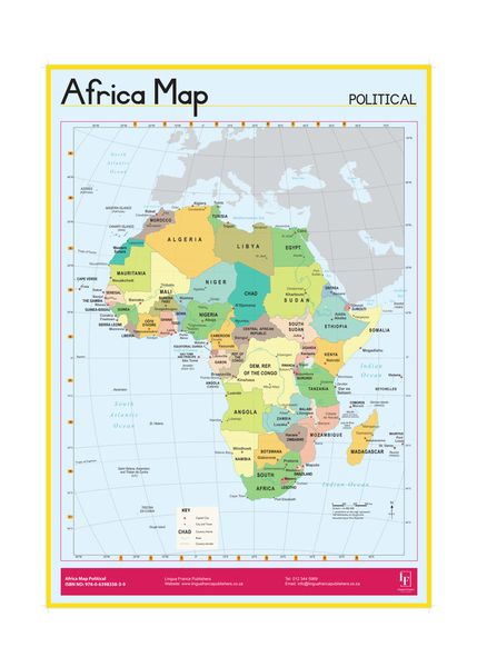
African Political Map wall chart
4.0
Positive
Top Rated
Buying option
store
takealot.com
Best Deal
In stockThe Story
This educational wall chart features a detailed political map of Africa, clearly showing countries, borders, capital cities, and major rivers. Printed in full color on uncoated paper, it is an ideal learning tool for classrooms, offices, or home study.
add_circle The Upside
- check Clear and easy-to-read political boundaries
- check Affordable educational tool
- check Suitable for both children and adults
remove_circle The Downside
- close Uncoated paper may be less durable
- close Only front side is printed
- close No additional physical features like topography
Specifications & features
Key features
- check_circle Shows all African countries and their borders
- check_circle Labels capital cities and major rivers
- check_circle Full-color printing on uncoated paper
- check_circle Large wall chart format for easy viewing
- check_circle Educational resource for geography learning
Specifications
Map Type
Political
Paper Type
Uncoated
Printing
Full Color (Front Only)
Product Type
Wall Chart
Tags
Loading more…
End of feed
Could not load more items
Keep discovering
Sign in to browse more of your personalised feed (new accounts use social login).